Articles 2 and 4
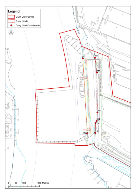
SCHEDULE 6QUAY LIMITS
| British National Grid | WGS84 DDM | |||
|---|---|---|---|---|
| Name | easting | northing | Longitude | Latitude |
| H1 | 454860.2626 | 525337.9453 | -1 09.11543 | 54 37.21298 |
| H2 | 454888.5753 | 524853.5247 | -1 09.09457 | 54 36.95162 |
| H3 | 454940.7694 | 524856.5634 | -1 09.04605 | 54 36.95292 |
| H4 | 454942.22 | 524922.23 | -1 09.04395 | 54 36.98832 |
| H5 | 454949.27 | 524933.64 | -1 09.03728 | 54 36.99442 |
| H6 | 454954.44 | 524988.22 | -1 09.03187 | 54 37.02382 |
| H7 | 454950.46 | 525246.97 | -1 09.03265 | 54 37.16335 |
| H8 | 454938.4032 | 525342.4282 | -1 09.04278 | 54 37.21488 |